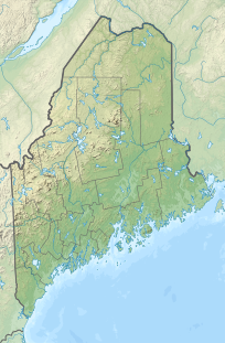
Bauneg Beg Mountain


Bauneg Beg Mountain is a mountain summit located in the town of North Berwick, in York County in the state of Maine. Bauneg Beg Mountain climbs to 860 ft (260 m) above sea level. Bauneg Beg Mountain is taller than Mount Agamenticus, and has been used by mariners to navigate the Maine Coast. This area is characterized by rolling forested hills, broad stream valleys, and numerous swamps.
Bauneg Beg Mountain is the only mountain in southern Maine that does not have a radio tower on it.[2] It is home to the small whorled pogonia (Isotria medeoloides), one of the rarest orchids in the Eastern United States as well as the rare swamp saxifrage (Saxifraga pensylvanica) and Blanding's turtle (Emys blandingii).[3]
References
External links
- Bauneg Beg Lake webpage: http://baunegbeg.wikifoundry.com/
- Bauneg Beg Lake Association http://www.baunegbeg.net/
- MountainZone.com
- v
- t
- e
- Boundary Peak
| Mahoosuc Range |
|
|---|---|
| Others |
- Baker Mountain
- Bauneg Beg Mountain
- Big Moose Mountain
- Big Spencer Mountain
- Black Cap Mountain
- Black Nubble
- Blueberry Mountain
- Borestone Mountain
- Boundary Bald Mountain
- Bradbury Mountain
- Cadillac Mountain
- Caribou Mountain
- Catherine Mountain
- Clark Mountain
- Coburn Mountain
- Crocker Mountain
- Crotch Hill
- Doubletop Mountain
- Douglas Mountain
- East Kennebago Mountain
- Eaton Mountain
- Elephant Mountain (Oxford County)
- Elephant Mountain (Piscataquis County)
- Fort Mountain
- Great Pond Mountain
- Greenwood Mountain
- Hamlin Peak
- High Peaks
- Kennebago Divide
- Kibby Mountain
- Lead Mountain
- Mars Hill
- Mount Abraham
- Mount Bigelow
- Mount Blue
- Mount Coe
- Mount Jefferson
- Mount Katahdin
- Mount Kineo
- Mount Redington
- Mount Tire'm
- Mount Waldo
- Moxie Mountain
- North Brother
- Noyes Mountain
- Pleasant Mountain
- Rollins Mountain
- Saddleback Horn
- Saddleback Junior
- Saddleback Mountain (Franklin County)
- Saddleback Mountain (Piscataquis County)
- Sandy Bay Mountain
- Shutdown Mountain
- Snow Mountain (Franklin County)
- Snow Mountain (Oxford County)
- South Brother
- South Crocker Mountain
- Spaulding Mountain
- Stetson Mountain
- Sugarloaf Mountain
- Titcomb Mountain
- Traveler Mountain
- Tumbledown Mountain
- West Kennebago Mountain
- Western Maine Mountains
- White Cap Mountain (Franklin County)
- White Cap Mountain (Piscataquis County)
 | This Maine state location article is a stub. You can help Wikipedia by expanding it. |
- v
- t
- e


