Güicán
Municipality in the department of Boyacá, Colombia
Municipality and town in Boyacá, Colombia

Flag

Seal
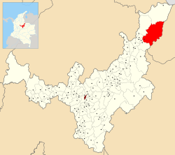
Location of the municipality and town of Güicán in the Boyacá Department of Colombia.
 Colombia
 Boyacá
(2020-2023)
(2020)
151440
Güicán de la Sierra, also known as Nuestra Señora de la Candelaria de Güicán, is a town and municipality in the Colombian Department of Boyacá. It is close to the national natural park El Cocuy National Park.[1] As of the year 2020, it has a total population of 6,426.[2]
Etymology
The municipality was named after Güicán tribe, an indigenous people who inhabited this region and is related to the U'wa people. The name Güicán means "in the fence of the wife" in the indigenous language.[3]
History

The conquistador of this territory was Hernán Pérez de Quesada, who arrived with his troops in search of gold. The aborigines withdrew behind the Sierra Nevada to escape from the Spanish.[4] The municipality was founded by a Jesuit friar Miguel Blasco on February 26, 1756.[5]
Geography
The municipality borders Chiscas and Cubará on the north, Fortul and Saravena on the east, Tame and El Cocuy on the south, as well as Panqueba and El Espino on the west. Its average elevation is at 3,492 meters above the sea level.[6]
Climate
Güicán has a Tundra Climate (ET). It receives the most amount of rainfall in April, with 244 mm of average precipitation; and the least in January, with 83 mm of average precipitation.
| Climate data for Güicán, elevation 2,963 m (9,721 ft), (1981–2010) | |||||||||||||
|---|---|---|---|---|---|---|---|---|---|---|---|---|---|
| Month | Jan | Feb | Mar | Apr | May | Jun | Jul | Aug | Sep | Oct | Nov | Dec | Year |
| Mean daily maximum °C (°F) | 20.1 (68.2) | 20.6 (69.1) | 20.2 (68.4) | 18.8 (65.8) | 18.4 (65.1) | 18.3 (64.9) | 18.1 (64.6) | 18.5 (65.3) | 18.7 (65.7) | 18.5 (65.3) | 18.4 (65.1) | 19.2 (66.6) | 18.9 (66.0) |
| Daily mean °C (°F) | 13.5 (56.3) | 13.6 (56.5) | 13.7 (56.7) | 13.4 (56.1) | 13.2 (55.8) | 13.0 (55.4) | 12.9 (55.2) | 12.9 (55.2) | 12.9 (55.2) | 12.9 (55.2) | 12.9 (55.2) | 13.2 (55.8) | 13.2 (55.8) |
| Mean daily minimum °C (°F) | 7.3 (45.1) | 7.6 (45.7) | 8.1 (46.6) | 8.8 (47.8) | 9.1 (48.4) | 8.8 (47.8) | 8.3 (46.9) | 8.1 (46.6) | 8.2 (46.8) | 8.3 (46.9) | 8.2 (46.8) | 7.6 (45.7) | 8.2 (46.8) |
| Average precipitation mm (inches) | 28.0 (1.10) | 41.9 (1.65) | 83.9 (3.30) | 119.2 (4.69) | 138.8 (5.46) | 91.5 (3.60) | 82.1 (3.23) | 91.9 (3.62) | 103.8 (4.09) | 135.5 (5.33) | 103.2 (4.06) | 51.2 (2.02) | 1,032.7 (40.66) |
| Average precipitation days (≥ 1.0 mm) | 8 | 10 | 15 | 19 | 23 | 22 | 22 | 21 | 20 | 22 | 19 | 13 | 206 |
| Average relative humidity (%) | 81 | 80 | 82 | 85 | 87 | 87 | 86 | 85 | 85 | 85 | 86 | 83 | 84 |
| Source: Instituto de Hidrologia Meteorologia y Estudios Ambientales[7] | |||||||||||||
| Climate data for Güicán (Sierra Nevad Cocuy), elevation 3,716 m (12,192 ft), (1981–2010) | |||||||||||||
|---|---|---|---|---|---|---|---|---|---|---|---|---|---|
| Month | Jan | Feb | Mar | Apr | May | Jun | Jul | Aug | Sep | Oct | Nov | Dec | Year |
| Mean daily maximum °C (°F) | 13.2 (55.8) | 12.4 (54.3) | 12.2 (54.0) | 11.4 (52.5) | 11.1 (52.0) | 11.2 (52.2) | 11.2 (52.2) | 11.3 (52.3) | 11.3 (52.3) | 11.2 (52.2) | 11.4 (52.5) | 12.0 (53.6) | 11.7 (53.1) |
| Daily mean °C (°F) | 7.2 (45.0) | 6.9 (44.4) | 7 (45) | 6.8 (44.2) | 6.7 (44.1) | 6.7 (44.1) | 6.6 (43.9) | 6.6 (43.9) | 6.6 (43.9) | 6.5 (43.7) | 6.6 (43.9) | 6.9 (44.4) | 6.8 (44.2) |
| Mean daily minimum °C (°F) | −0.5 (31.1) | −0.1 (31.8) | 0.8 (33.4) | 1.3 (34.3) | 1.7 (35.1) | 1.7 (35.1) | 1.4 (34.5) | 1.4 (34.5) | 1.4 (34.5) | 1.4 (34.5) | 1.3 (34.3) | 0.6 (33.1) | 1.0 (33.8) |
| Average precipitation mm (inches) | 23.4 (0.92) | 38.4 (1.51) | 64.6 (2.54) | 120.7 (4.75) | 138.4 (5.45) | 98.4 (3.87) | 82.5 (3.25) | 90.0 (3.54) | 103.8 (4.09) | 128.1 (5.04) | 99.6 (3.92) | 53.7 (2.11) | 1,031 (40.6) |
| Average precipitation days (≥ 1.0 mm) | 6 | 9 | 11 | 18 | 23 | 21 | 20 | 20 | 20 | 21 | 18 | 13 | 193 |
| Average relative humidity (%) | 84 | 84 | 84 | 85 | 85 | 85 | 86 | 86 | 86 | 86 | 86 | 85 | 85 |
| Mean monthly sunshine hours | 220.1 | 183.5 | 164.3 | 108.0 | 96.1 | 117.0 | 145.7 | 139.5 | 111.0 | 105.4 | 129.0 | 186.0 | 1,705.6 |
| Mean daily sunshine hours | 7.1 | 6.5 | 5.3 | 3.6 | 3.1 | 3.9 | 4.7 | 4.5 | 3.7 | 3.4 | 4.3 | 6.0 | 4.7 |
| Source: Instituto de Hidrologia Meteorologia y Estudios Ambientales[7] | |||||||||||||
Galleries
-
 Río Cóncavo as it passes through Güicán.
 -
 View of the rural sector of Güicán.
 -
 Main altar of the Sanctuary of the Morenita Virgin
 -
 Old physical plant of the ENS Nuestra Señora del Rosario de Güicán.


References
- ^ Paz, Manuel María. "View of the Snow-capped Mount Chita and of the Great Snowfields near Güicán, Province of Tundama". World Digital Library. Retrieved 2014-05-21.
- ^ COLOMBIA. PROYECCIONES DE POBLACIÓN MUNICIPALES POR ÁREA (in Spanish). Retrieved 2023-04-05.
- ^ "BOYACÁ-GÜICÁN". www.colombiaturismoweb.com (in Spanish). Archived from the original on 2023-04-05.
- ^ Fajardo, José del Rey (2006). Los Jesuitas en Venezuela: Las misiones germen de la nacionalidad (in Spanish). Universidad Catolica Andres. p. 133. ISBN 978-980-244-519-6.
- ^ "Nuestro Municipio, Información general". www.guican-boyaca.gov.co (in Spanish). Archived from the original on 2015-05-29. Retrieved 2023-04-05.
- ^ "Güicán topographic map, elevation, terrain". Topographic maps. Retrieved 2023-04-05.
- ^ a b "Promedios Climatológicos 1981–2010" (in Spanish). Instituto de Hidrologia Meteorologia y Estudios Ambientales. Archived from the original on 15 August 2016. Retrieved 3 June 2024.
- v
- t
- e

- Chiscas
- El Cocuy
- El Espino
- Guacamayas
- Güicán
- Panqueba
See also: List of municipalities in Boyacá


